")

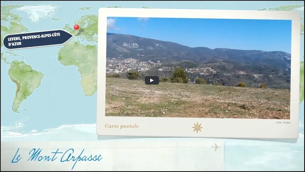
Mont Arpasse
A magical site in a grandiose setting, located a few kilometers from Levens.
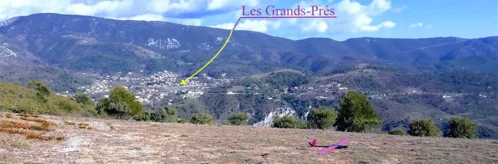 With the view, in the distance, slightly to the left, Grands Prés de Levens
A little harder to find alone because you have to take a forest trail. It would be better to contact us before.
It can fly without problem, with gliders up to 4 meters.
How to go to Arpasse ...
From the meadows, which everyone knows, continue to Levens
Take 500 m left on the road to La Roquette.
Two laces further take on the right the small road that leads to "firefighters".
Then, past an AVIA petrol station, turn left again towards the fire brigade and just before the firemen's fire station take the "La Mole road" always left.
The road climbs, we pass two laces then, arrived on the flat, turn right on a track that plunges into the hollow of the valley (21-22 MTB route and mustard color villa on the right) follow it to the relay antenna where we will leave the vehicle (about 1 km of track in good condition).
Then, we go to the pseudo-sporting phase by following the track to the flight site just behind the weather station (short-cut trails allow you to cut the laces).
Athletes will settle the case in 20 minutes and it will take about 30 minutes to poets.
Another alternative, more bucolic, is to continue the road to La Mole almost to the end (leave the car at the small parking lot on the left). 10 m further, on the right, there is a path that seems to lead to a gate, but just before the gate the path is on the left. This path will take us to a track that we will take on the right and after a small steep path we will be on the slope. (For the warriors, it is possible, right out of the wooded area, to take right, in the slope, direct to the site of flight)
The boredom of this itinerary (a little shorter than the previous one) is that the trail is not very wide and with a glider in the back it's a little less convenient. To be well shod is rather advisable.
This zone is referenced on the aeronautical charts by the DGAC 1.
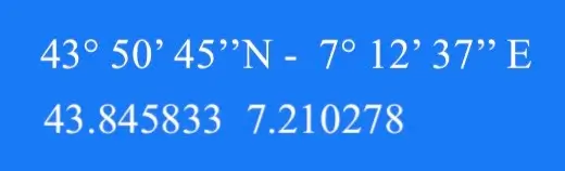 GPS position of L'Arpasse
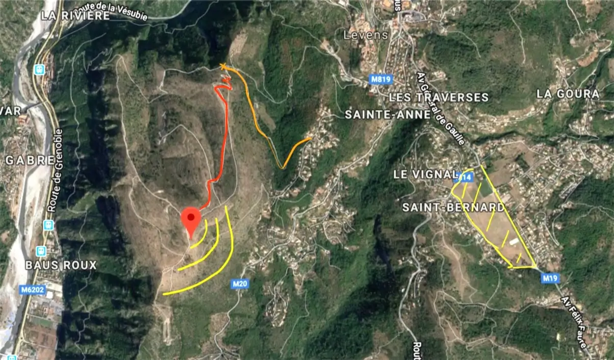
Explanatory map .... Option 1
in orange the track ... arrived at the relay antenna ... we park.
in red, walking on foot! ... 20 minutes, 150 meters of uneven, 1.3 km ...
in yellow the flight zone of Arpasse and that of Grands-Pré.
 card with handwritten indication
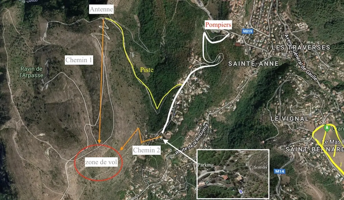
Explanatory card option 2
Start small parking and very steep trail ... 15 minutes, 150 m of uneven, about 1 km.
advantage: no track with the vehicle, disadvantage: steeper slope!
 card with another handwritten indication
Our manager for the Arpasse site is one of our members: Mr Francis L.
You can contact us so that we put you in relation.
A short video of this beautiful site Sur YouTube
 Video Flight at Arpasse
Thanks to Jacques B. and Stéphane R. for these beautiful videos and images ...
Flight with a lost wheel !
* Do not worry, the wheel was recovered after landing!
Enjoy the flights everyone.
- Position of Mont-Arpasse near LEVENS with
- Google Maps
- DGAC 1
- Website of the French Civil Aviation Authority